Sailing trip Holland
A 3-week sailing trip from Lemmer Holland
Sailing trip on the North Sea IJsselmeer and Wadden Sea in Holland 15.07. – 05.08.
There is a supermarket about 200m from the city harbor, which was ideally suited to stock our ship for the three-week sailing trip in Holland.
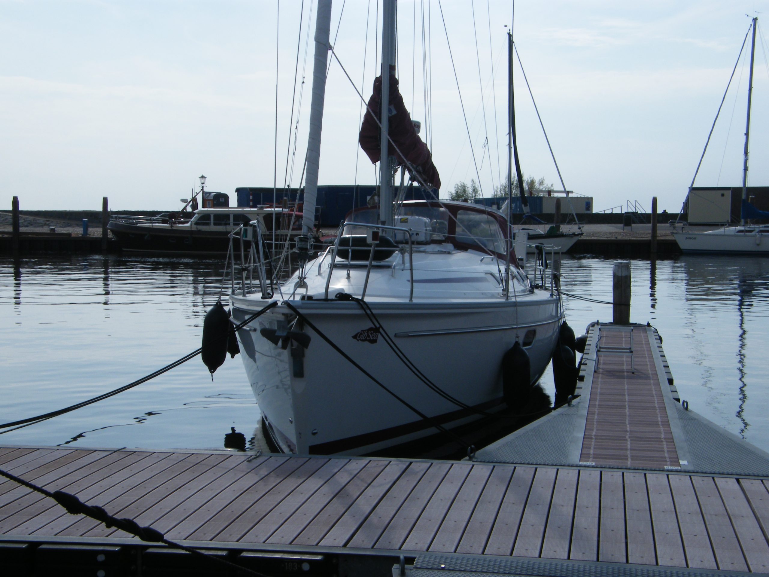
In our chartered Bavaria 32 there was enough space to stow everything carefully. Our sailing trip Holland plan was to cross the IJsselmeer via Enkhuizen, Edam and Volendam to Amsterdam. The weather cooperated and gave us decent wind. From Amsterdam, after a few days in Six-Haven, we went west along the North Sea Canal to Ijmuiden.
Ijmuiden Northsea
Ijmuiden is one of the gates to the North Sea in Holland. The port “Seaport Marina Ijmuiden” is very well equipped and has electricity, water, very good sanitary facilities, marine accessories, a supermarket and restaurants. Various needs are taken care of at this port before the “big voyage” starts. Ijmuiden City and Haarlem can be reached by bus.
In the days that we previously spent in Amsterdam, a storm warning was issued in the port, with wind force 7 on the North Sea, for sailing boats. Our weather forecast for the day was: low over England, cloudy, wind force 3-4 off North-west and temperatures between 18-23 degrees Celsius. The waves of the North Sea, which had built up in the previous 3 days, could still be felt clearly. Our ship successfully stamped its way through the port exit. Then the sails were set in reef 1 in order to cope with the approx. 30 nm to the lighthouse of Den Helder, with a course of 10 degrees.
The ideal time to set sail is 1 hour before the high tide in IJmuiden.
Waddensea
At high tide, the North Sea flows from west to east and ideally for us into the Wadden Sea. When we had reached the first buoys to enter the Wadden Sea off the island of Texel, we clearly saw the strong current, according to a correct calculation, in the direction of travel. According to the map, the water flows at 3 knots about 5 hours before high tide. Driving on the Wadden Sea with half the wind and current from behind was very relaxing in contrast to the rough North Sea. We drove purposefully to the port of Oudeschild on Texel and were even greeted by a passing seal. The port offers sufficient berths with electricity connections and water supply. A small supermarket supplies the essentials daily from 8 a.m. to 9 p.m. during the season. The freshly baked rolls are particularly recommended, next to a rental station for bicycles.
Texel
Aerial view of the port in Oude Schild on Texel.
There are various restaurants and shops on site. The port building has modern sanitary facilities as well as washing machines and dryers. Internet access is also available for a little change. A bike tour across Texel is highly recommended, combined with a visit to the largest town on the island, Den Burg, the seal station “EcoMare”, the airfield on Texel and from the lighthouse back over the south-eastern dam to the marina.
The eastern tip of Texel from the air.
From Texel it’s about the western tip of the island back out onto the North Sea. There are about 25 nm north-east course ahead of us. The destination is the port of Vlieland. We cast off in Oudeschild an hour before high tide to sail out of the Wadden Sea with the ebb current. With the onset of high water, the direction of the current was again identical to our course. At the height of the Texel lighthouse, I recommend leaving the northern danger buoy on the starboard side. The entrance to the Wadden Sea between Vlieland and Terschelling has been turned off and leads directly to the port with a narrow buoy distance.
Vlieland harbor entrance.
It is recommended to contact the harbor master beforehand to inquire about free berths in the harbor. This port is often closed during the season for capacity reasons. Electricity, water and sanitary facilities are available. My recommendation is to carry a Y-cable or splitter with you to share the power connection with your neighbor.
Packets of seven are not uncommon in the port
Oost-Vlieland is the only place on the approx. 20 km long and 2 km wide island. It is only 500 m from the port to the town center, there is a ferry port on site and restaurants and shops of all kinds bustle in the village street, and an internet shop is also available. The rest of the sea island consists of dunes, forests and meadows. Tourists who are not allowed to travel by car get lost on the 12 km long sandy beach. When the visibility is good, seals can be seen on the nearby sand island “Richel”. In the evening we could admire a colony at low tide.
Our trip of 12 nautical miles through the excellently concreted Wadden Sea took us from Vlieland to Terschelling. From a distance we recognized the “Brandaris”, the 54 m high lighthouse, which stands in the center of West-Terschelling and whose light signals can be seen up to 40 km away.
Terschelling
We headed for the only marina in West-Terschelling.
Cars are allowed on this island, so Dutch tourists in particular spend their holidays on Terschelling and travel by ferry. Due to the 30 km long sandy beach, which is up to 500 m wide in places, the many visitors to the island spread out easily in sunny weather, so that there is still enough scope for a variety of activities on the beach. With a suitable ship and the right weather conditions, it is Of course, it is also possible to find a quiet bay in the Wadden Sea. At low tide, the ship then falls dry and the beach is right in front of the bathing ladder.
The next port on the mainland is that of Harlingen. The small seafarer’s place with the old warehouses is now the most important ferry port to Terschelling and Vlieland. As well as the starting point for trips to the Wadden Sea. The entrance to the port, like the entire Wadden Sea, is very well toned. When the weather is calm, the gates are open and the two bridges are regularly used to enter the outer harbor. The bridge to the city harbor is opened at a quarter past and a quarter to.
The city harbor of Harlingen.
From Harlingen it is approx. 10 nm to Kornwerderzand through the Boontjes stream. With a draft of our ship of 1.50 m, sailing is possible. The nautical charts show a depth of 1.6 m between the buoys. The best time to go with the current on this route from Harlingen to Kornwerderzand is when the tide starts to fall. Shortly before reaching the Lorenzsluizen in Kornwerderzand, a seal affectionately said goodbye to us by briefly appearing. We reached the lock master on channel 18 via VHF radio and kindly asked to smuggle us into the IJsselmeer. As a tip for a possible start on an extended cruise in the Wadden Sea, I would like to recommend the Makkum Marina. An excellent system with water and electricity at every berth. Clean and spacious sanitary facilities, playgrounds and pool for children as well as a supermarket on the premises with fair prices and open 7 days a week in the season.
In summary of the Sailing Tours Holland, I would like to state as an enthusiastic sailor that Holland, as one of the oldest seafaring nations, is ideally suited to indulging in this hobby. Moderate berth fees in cozy harbors and towns. Excellent concreted waterways, locks and bridges, which are served friendly at any time. A trip on the IJssel or Wadden Sea as well as on the North Sea can very quickly develop into a demanding and even dangerous trip, as the weather here can change, for example, under rapidly approaching low pressure areas. In addition there is the consideration of the tides, whose currents also cause over 3 knots. This requires a certain amount of experience as well as the corresponding navigation and safety equipment on board.
© by Frank | Segeltörn Holland


